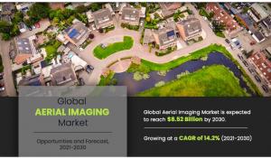
By end user, agriculture and forestry segment is projected to lead the global market in terms of market share by the end of the forecast period.
𝐑𝐞𝐪𝐮𝐞𝐬𝐭 𝐒𝐚𝐦𝐩𝐥𝐞 𝐏𝐚𝐠𝐞𝐬 𝐍𝐨𝐰: https://www.alliedmarketresearch.com/request-sample/294
The need for land mapping is growing prominently across the world with Asia-Pacific exhibiting the highest growth rate. The traditional solutions such as, control point method, triangulation, trilateration, compass, transits, metal tapes, and others are proving inefficient for the estimation and planning of land & natural resources. In such scenarios, aerial imaging services have emerged as an effective tool for disaster management, forest & natural resource management, and entertainment projects. The use of technologically advanced mapping software, camera solutions, unmanned vehicles, and sensors reduces the risks associated with cost estimation, wastage of materials, project completion, and conflict resolution during every stage of project management.
𝐓𝐡𝐞 𝐤𝐞𝐲 𝐩𝐥𝐚𝐲𝐞𝐫𝐬 𝐩𝐫𝐨𝐟𝐢𝐥𝐞𝐝 𝐢𝐧 𝐭𝐡𝐢𝐬 𝐫𝐞𝐩𝐨𝐫𝐭 𝐢𝐧𝐜𝐥𝐮𝐝𝐞
𝐀𝐞𝐫𝐢𝐚𝐥 𝐈𝐦𝐚𝐠𝐢𝐧𝐠 𝐏𝐫𝐨𝐝𝐮𝐜𝐭𝐢𝐨𝐧𝐬, 𝐋𝐋𝐂
𝐁𝐥𝐨𝐦 𝐍𝐨𝐫𝐰𝐚𝐲 𝐀𝐒
𝐂𝐨𝐨𝐩𝐞𝐫 𝐀𝐞𝐫𝐢𝐚𝐥 𝐒𝐮𝐫𝐯𝐞𝐲𝐬 𝐂𝐨.
𝐃𝐢𝐠𝐢𝐭𝐚𝐥 𝐀𝐞𝐫𝐢𝐚𝐥 𝐒𝐨𝐥𝐮𝐭𝐢𝐨𝐧𝐬 (𝐃𝐀𝐒), 𝐋𝐋𝐂
𝐄𝐚𝐠𝐥𝐞𝐕𝐢𝐞𝐰 𝐓𝐞𝐜𝐡𝐧𝐨𝐥𝐨𝐠𝐢𝐞𝐬, 𝐈𝐧𝐜.
𝐅𝐮𝐠𝐫𝐨 𝐍.𝐕.
𝐆𝐥𝐨𝐛𝐚𝐥 𝐔𝐀𝐕 𝐓𝐞𝐜𝐡𝐧𝐨𝐥𝐨𝐠𝐢𝐞𝐬 𝐋𝐭𝐝
𝐊𝐮𝐜𝐞𝐫𝐚 𝐈𝐧𝐭𝐞𝐫𝐧𝐚𝐭𝐢𝐨𝐧𝐚𝐥
𝐋𝐚𝐧𝐝𝐢𝐬𝐜𝐨𝐫
𝐍𝐞𝐚𝐫𝐦𝐚𝐩 𝐋𝐭𝐝.
𝐁𝐮𝐲 𝐍𝐨𝐰 𝐭𝐡𝐞 𝐄𝐱𝐜𝐥𝐮𝐬𝐢𝐯𝐞 𝐑𝐞𝐩𝐨𝐫𝐭: https://www.alliedmarketresearch.com/checkout-final/bb3649c90d77759ae3567288d4dd6235
The application of aerial imaging is influenced by its increased implementation across various verticals, surge in use of aerial imaging for disaster risk reduction and prevention, and use of aerial imaging technology in setting up 5G infrastructure. However, rising concerns over cyber-security and data security in drones and emergence of satellite imagery solutions restricts their adoption.
Based on application, the geospatial mapping segment held the highest market share in 2020, accounting for one-fourth of the global aerial imaging market, and is estimated to maintain its leadership status throughout the forecast period. This is because geographical mapping through satellites has a wide range of applications in various sectors such as environmental condition analysis, archaeology, mining study and formation of maps and charts etc. Moreover, the urban planning segment is projected to manifest the highest CAGR of 17.2% from 2021 to 2030, owing to growing activities related with urban planning such as land inspection, identification of population risk and tracking of construction activities and others.
𝐆𝐞𝐭 𝐂𝐮𝐬𝐭𝐨𝐦𝐢𝐳𝐞𝐝 𝐑𝐞𝐩𝐨𝐫𝐭𝐬 𝐰𝐢𝐭𝐡 𝐲𝐨𝐮’𝐫𝐞 𝐑𝐞𝐪𝐮𝐢𝐫𝐞𝐦𝐞𝐧𝐭𝐬: https://www.alliedmarketresearch.com/request-for-customization/294
Based on region, North America held the highest market share in terms of revenue 2020, accounting for nearly two-fifths of the global aerial imaging market, owing to high adoption of aerial imagery among government and military agencies in the region. Moreover, the Asia-Pacific region is expected to witness the fastest CAGR of 16.0% during the forecast period, increase adoption of aerial imaging in various end use sectors in the region.
𝐈𝐧𝐭𝐞𝐫𝐞𝐬𝐭𝐞𝐝 𝐭𝐨 𝐏𝐫𝐨𝐜𝐮𝐫𝐞 𝐭𝐡𝐞 𝐑𝐞𝐬𝐞𝐚𝐫𝐜𝐡 𝐑𝐞𝐩𝐨𝐫𝐭? 𝐈𝐧𝐪𝐮𝐢𝐫𝐞 𝐁𝐞𝐟𝐨𝐫𝐞 𝐁𝐮𝐲𝐢𝐧𝐠: https://www.alliedmarketresearch.com/purchase-enquiry/294
𝐊𝐄𝐘 𝐅𝐈𝐍𝐃𝐈𝐍𝐆𝐒 𝐎𝐅 𝐓𝐇𝐄 𝐒𝐓𝐔𝐃𝐘
By Application, the geospatial mapping segment is expected to register significant growth during the forecast period.
By end user, agriculture and forestry segment is projected to lead the global market in terms of market share by the end of the forecast period.
By platform, the UAV and Drone segment is projected to lead the global market, in terms of market share, by the end of the forecast period.
By region, North America dominated the global aerial imaging market in 2020 in terms of market share.
𝐂𝐡𝐞𝐜𝐤 𝐨𝐮𝐭 𝐦𝐨𝐫𝐞 𝐫𝐞𝐥𝐚𝐭𝐞𝐝 𝐬𝐭𝐮𝐝𝐢𝐞𝐬 𝐩𝐮𝐛𝐥𝐢𝐬𝐡𝐞𝐝 𝐛𝐲 𝐀𝐌𝐑 𝐑𝐞𝐬𝐞𝐚𝐫𝐜𝐡:
Commercial Satellite Imaging Market - https://www.prnewswire.com/news-releases/commercial-satellite-imaging-market-to-reach-6-99-billion-globally-by-2030-at-10-8-cagr-allied-market-research-301469496.html
Aircraft Health Monitoring System Market - https://www.globenewswire.com/en/news-release/2022/06/22/2466995/0/en/Aircraft-Health-Monitoring-System-Market-to-Garner-7-27-Billion-by-2030-Allied-Market-Research.html
Helicopter Simulation Market - https://www.globenewswire.com/en/news-release/2023/03/23/2633179/0/en/Helicopter-Simulation-Market-Size-to-Generate-1-8-Billion-by-2031-Allied-Market-Research.html
Space Debris Monitoring and Removal Market - https://www.prnewswire.com/news-releases/space-debris-monitoring-and-removal-market-to-reach-2-010-3-million-by-2032-at-7-7-cagr-allied-market-research-301986980.html
David Correa
Allied Market Research
+1 800-792-5285
email us here
Visit us on social media:
Facebook
X
Legal Disclaimer:
EIN Presswire provides this news content "as is" without warranty of any kind. We do not accept any responsibility or liability for the accuracy, content, images, videos, licenses, completeness, legality, or reliability of the information contained in this article. If you have any complaints or copyright issues related to this article, kindly contact the author above.


